![]()
The Coalition for a Livable Future’s Regional Equity Atlas, the country’s first equity atlas project, is a research and education initiative to promote a stronger, healthier, and more sustainable Portland metropolitan region. The original Regional Equity Atlas, published in 2007, received widespread attention for its groundbreaking analysis of regional inequities. By illuminating the region’s geography of opportunity, the Regional Equity Atlas transformed conversations around equity and helped shape local advocacy and policymaking to address disparities.
CLF and its partners used the original Regional Equity Atlas findings to secure changes in regional planning and investment decisions. Local governments have relied on the Regional Equity Atlas maps to shape their understanding of the region’s needs.
| What is Regional Equity? Click here for CLF's definition. Click here to view other definitions |
Examples of the Regional Equity Atlas’s impact include the creation of a multimillion-dollar grant program that has expanded access to nature in low-income neighborhoods; redirection of millions of dollars in public funding towards sidewalk projects in communities where low-income residents did not have access to walkable neighborhoods; the decision by the City of Portland to set aside 30 percent of all tax increment financing dollars to support affordable housing; advances in access to transportation options; and increased access to green jobs for minorities.
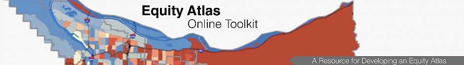
Regional Equity Atlas 2.0, released in 2013, updates and expands upon the first Regional Equity Atlas to provide stakeholders with a powerful tool for understanding how well different neighborhoods and populations are able to access essential resources. It includes three main components:
| Click here to view the Regional Equity Atlas 2.0 brochure. (PDF) |
- Web-based mapping tool: This tool enables people to create customized maps on a wide range of issues.
- Explanation and interpretation of the findings: A website provides sample maps, preliminary analysis, user manuals, and additional data.
- Outreach and education initiative: This includes training, information, and technical assistance to engage partners across the region in using the Regional Equity Atlas 2.0 to create concrete changes in policies and priorities.
The Regional Equity Atlas 2.0 mapping tool includes data by neighborhood or census tract on a wide range of priority areas that were identified by regional stakeholders:
- Demographics: This includes information on race, ethnicity, income, age, and household composition.
- Access measures: These measures include proximity to clean air, food, housing, transportation, parks and nature, education, economic opportunity, services, and other community resources.
- Health measures: These measures include access to medical providers and preventive care; birth outcomes; and rates of asthma, diabetes, and cardiovascular disease.
Since the release of Regional Equity Atlas 2.0, CLF has engaged several thousand stakeholders in workshops and trainings to use the maps and data to explore equity issues from the perspective of their own communities and constituencies. CLF is also working with a range of partner organizations to analyze the disparities revealed by Regional Equity Atlas 2.0 maps and develop policy recommendations. This includes supporting community organizations in using the maps to illuminate barriers and opportunities and to advocate for change. It also includes working with interested government agencies to develop a framework to more effectively operationalize the concept of equity in planning and decision-making. See here for examples of how Regional Equity Atlas 2.0 has shaped recent policy, planning, and investment decisions in the Portland metro area.