Community Gardens
Community gardens offer a potential source of affordable, healthy food for neighborhood residents. They also promote sustainability by providing locally grown sources of nutrition. And they create neighborhood green spaces, places for physical activity, and opportunities for community building.
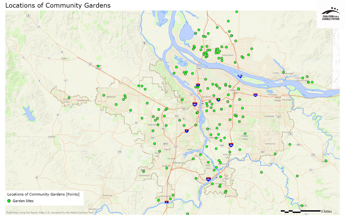
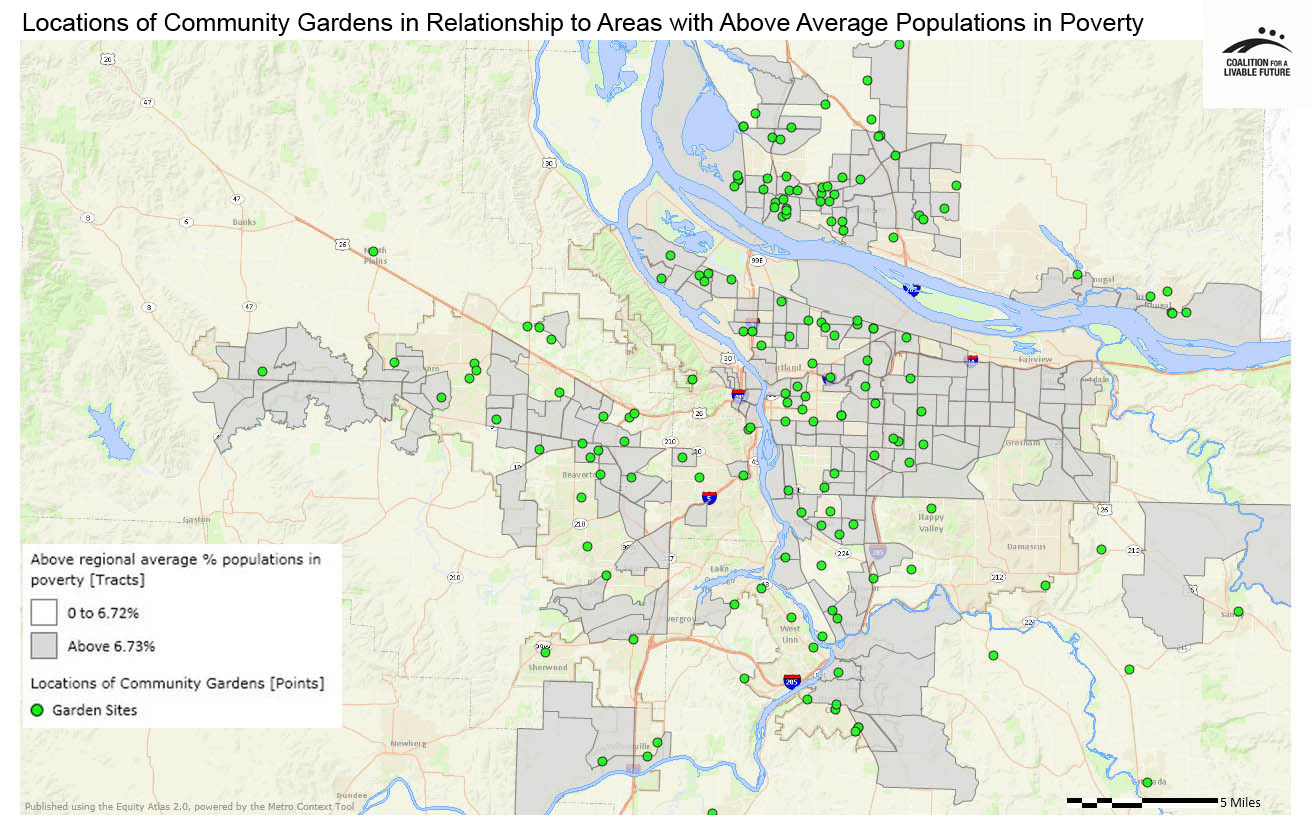
The maps in this series show the locations of community gardens across the region and then layer that information with data on the distribution of populations in poverty.


What the Maps Tell Us: Initial Findings
A visual scan of the Locations of Community Gardens map reveals the following neighborhoods as having the most gardens within their boundaries:
- Canby (Clackamas County) – 5 gardens
- Central Beaverton (Beaverton) – 3 gardens
- Central Park (Vancouver) – 5 gardens
- CPO 7 Sommerset – West Elmonica N (Washington County) – 3 gardens
- CPO 9 Hillsboro (Hillsboro) – 5 gardens
- Cully (Portland) – 5 gardens
- Fruit Valley (Vancouver) – 4 gardens
- Gaffney Lane (Oregon City) – 3 gardens
- Meadow Homes (Vancouver) – 3 gardens
- NE Hazel Dell (Vancouver) – 4 gardens
- Portsmouth (Portland) – 3 gardens
- Washougal (Clark County) – 4 gardens
- Wilsonville (Clackamas County) – 3 gardens
The Locations of Community Gardens in Relationship to Areas with Above Regional Average Percent Populations in Poverty map reveals a fairly consistent alignment between the locations of community gardens and census tracts with poverty rates above the regional average. This pattern is encouraging, since community gardens can offer an affordable source of healthy food for low-income households. However, this finding does not address whether the total number of community gardens in these communities is sufficient to meet the need, and many community gardens have limited capacity and extensive waiting lists. In addition, further research would be necessary to analyze the socioeconomic profile of the residents who have access to the region’s garden plots. If community garden programs do not work proactively to prioritize access to garden plots for lower income residents, the garden plots may not end up being utilized by the residents who need them the most.
While most of the region’s existing community gardens are located in census tracts with above average poverty levels, there is a notable lack of community gardens in several high poverty census tracts across the region. The largest swaths of high poverty census tracts with no community gardens are located in east Multnomah County, a few unincorporated areas of Clackamas and Washington counties, and several census tracts in and adjacent to Tigard and Cornelius.
About the Maps
Locations of Community Gardens
This map shows the location of publicly accessible community gardens in the region, but does not reflect the availability of community garden plots.
Data Source: Primary research through the web, contacting local organizations and neighborhood associations (2012)
Locations of Community Gardens in Relationship to Areas with Above Regional Average Percent Populations in Poverty
This map layers the census tracts with populations in poverty above the regional average underneath the Locations of Community Gardens point layer.
Data Source: American Community Survey 5-Year Estimates (2006-2010), Primary research through the web, contacting local organizations and neighborhood associations (2012)
|
This document was downloaded from the Map Series library of the Coalition for a Livable Future’s Regional Equity Atlas 2.0 website. The Regional Equity Atlas is a research and education project to promote widespread opportunity for a stronger, healthier, and more sustainable Portland-Vancouver metropolitan region. For more information, visit www.equityatlas.org. |
